

The time frame for the latest start-of-week storm is Sunday, Dec. 17 into Monday, Dec. 18, with the heaviest precipitation on Monday, the National Weather Service says.
Precipitation could transition to light snow in interior areas Monday evening and overnight into Tuesday, Dec. 19 when the temperature drops below freezing farther north.
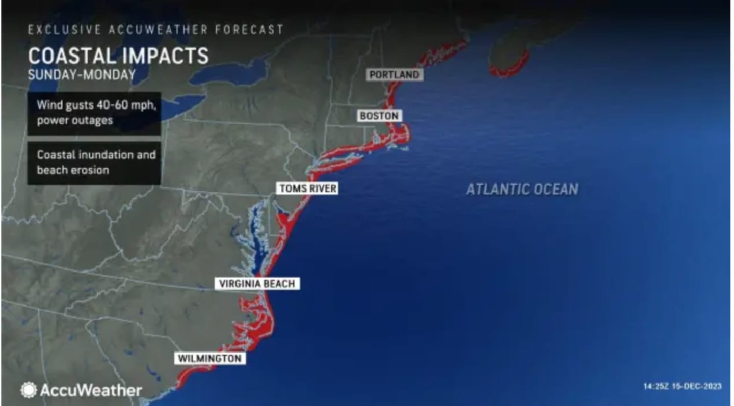
Wind advisories are in effect from midnight to noon on Monday for much of the region, with wind gusts expected to be between 40 and 60 mph.
"Gusty winds could blow around unsecured objects," the National Weather Service said in a Hazardous Weather Statement issued early Saturday morning, Dec. 16. "Tree limbs could be blown down, and a few power outages may result."
Areas in and around the coast outlined in red in the first image above from AccuWeather.com could see even stronger gusts.
"Wind gusts will range between 40 and 60 mph and could approach 70 mph along the coast," according to AccuWeather Chief On-Air Meteorologist Bernie Rayno.
Gusts of 74 mph or greater are considered hurricane-force winds, AccuWeather notes.
A widespread 2 to 4 inches of rainfall is expected, with locally higher amounts of up to 8 inches. (Click on the second image above for projected rainfall amounts.)
Rain could lead to flooding, causing travel difficulties on Monday.
Skies will thicken overnight Saturday, leading to a mostly cloudy day on Sunday ahead of the storm's arrival. The high temperature will be around 50 degrees.
Rainfall will move up from the south in the early to middle of the afternoon on Sunday, with rain becoming steady overnight into Monday. (Click on the third image above.)
During the height of the storm on Monday, a rare December thunderstorm is possible.
The heaviest rain should begin to wind down late Monday afternoon, followed by showers in the evening and at times overnight.
The outlook for Tuesday calls for partly sunny skies and brisk conditions with a high temperature in the upper 30s.
Check back to Daily Voice for updates.
Click here to follow Daily Voice Wilton and receive free news updates.