New update - Projected Snowfall Totals Increase As Nor'easter Nears: These Spots Could See 18 Inches
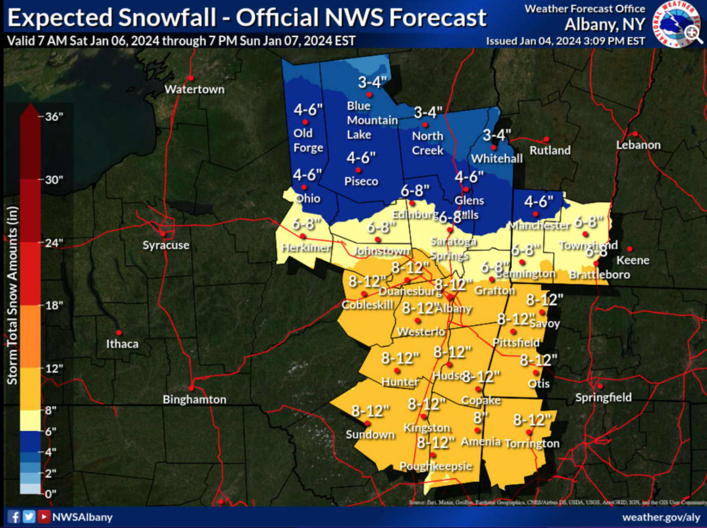
The latest National Weather Service projections have the most snowfall, up to a foot, in Albany, Dutchess, Ulster, Columbia, Greene, and Schoharie counties. (See the first image above.) Heavy snow is expected at times.
A Winter Storm Watch goes into effect at 4 p.m. Saturday, Jan. 6 and lasts through 7 p.m. Sunday, Jan. 7. Travel could be very difficult during that time, the National Weather Service is warning.
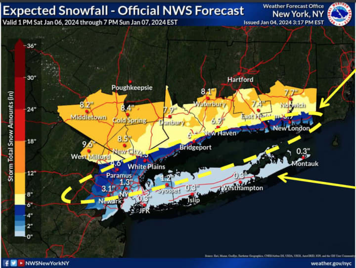
For snowfall projections farthest south in New York, click on the second image above.
During the storm's height, winds will be out of the Northeast at around 20 miles per hour with higher gusts, and power outages possible.
This continues to be a developing story. Check back to Daily Voice for updates.
Click here to follow Daily Voice Ulster Sullivan and receive free news updates.